I’m one of those people who craves the bright street lights, constant noise and buzzy energy of city life; I couldn’t picture living my life any other way. But it can get to be a little much at times. That’s when I strap on my hiking shoes and head to the woods.
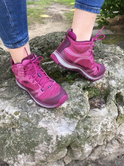
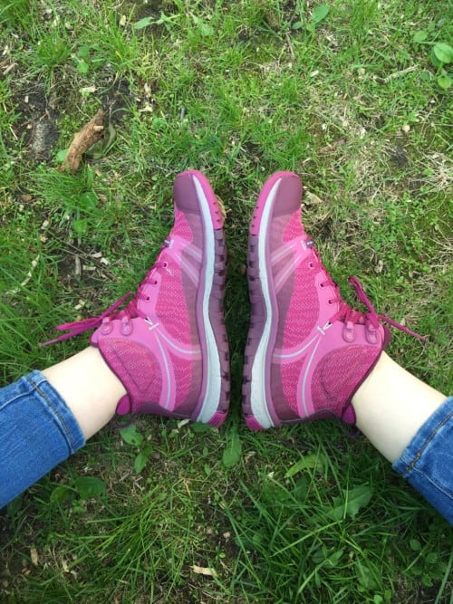
I used to go hiking and foraging in my regular sneakers, but after a close call with a particularly rough, off-the-grid trail, I made the switch to KEEN’s Terradoras. They’re cozy, lightweight, breathable and super cushioned. The best part? They’re cute enough to wear in the city.
For this reason, it only seemed appropriate that I team up with KEEN for this post. Dedicated to creating original, versatile products and inspiring outdoor adventures, I couldn’t think of a better fit than KEEN. Here are my favourite trails in the GTA that are super pretty and accessible for those of us who don’t drive.
EAST END
DYK there’s an awesome multi-use trail system that’s hiding right under our urban noses? Connected to the Lakeshore Road bike trail, and encompassing the Evergreen Brick Works, the Lower Don area has a bit of everything. To relax, the paved trail–mostly between the Don River and the DVP–is the way to go. If you’re looking to get your heart rate up, go off-path into the hilly climbs and offbeat mountain bike routes that will have you sweating.
The river itself is obviously the biggest attraction as it is oh-so pretty. Once the most polluted in the GTA, the river has been rehabilitated over the past twenty years and is currently home to carp populations and large herons, which are very fun to watch. TTC bus service is available and quite convenient.
Toronto officials decided a hundred years ago that the city needed another inner harbour and began constructing a spit in the Ashbridges Bay region. Mostly completed by the late 1950s, the harbour was no longer required once shipping moved to trucking. Left behind on the northern shore was the increasingly important Tommy Thompson Park.
It is now a major spot for migrating birds, and the hike in alone is easily worth the trip. Motor vehicles have to be left at the front gate so it’s all on-foot from there! Cracked old pavement slowly succumbs to the thrust of nature taking over and leading you to the GTA’s wildest trail. Good news! The brand-new TTC 83 bus takes you right in.
Of all the hikes and parks listed here, it’s the 4.7 km loop through the Scarborough Bluffs that you’ve likely seen in your Instagram feed. With breathtaking cliffs that cascade into Lake Ontario, the scenic views here are quite stupendous, but be careful how you selfie! Once you’re done your hike, head to the sandy beaches below for a dip. This is a definite hot spot during summer months, and for good reason. New this year, the TTC has a bus route that goes directly to The Bluffs. Find your route here.
WEST END
This one’s an obvious choice, but also a really good choice. With direct access from the 506 College streetcar, a trip to High Park can be accessed from downtown Toronto easily, and once you’re there, you’ll feel well removed from the hustle and bustle. For kids, there are many draws, including the free High Park Zoo and a giant playground that is designed like a castle. Spanning 161 hectares, this beautiful green space also has remarkable wetlands that surround the picturesque Grenadier Pond. If you’ve got a pup, this is also a favourite destination for pet owners as beyond the wooded hiking paths, there’s a terrific off-leash area. If you forget to pack a picnic, take a break at the Grenadier Café, which overlooks landscaped gardens.
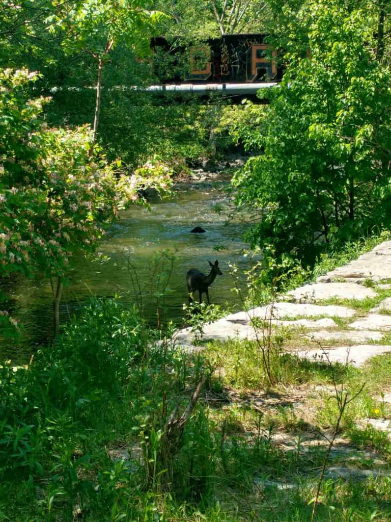
A river runs through it! The Humber River, and it’s really exhilarating to walk next to, especially in the early spring during the salmon run. This gorgeous conservational wonder is a five-minute walk from Old Mill subway station. Originally used as one of the major trading routes for First Nations people, and including a bridge built in 1837, this patch of splendour is rich with history, with a well-trodden hiking trail and picnic areas.
Erindale Park/ University of Toronto
The site of another damming project, Erindale Park and the bordering conserved lands of U of T in Mississauga have become a gem of the Credit River Park system. Ultimately unsuccessful, the dam was removed and serves as a nice historical relic to start the trek. The pièce de résistance is the ridge trail along the UTM side, starting at the Dean’s House.
Beautiful vistas of the river below and large chunks of old forest within walking distance of the suburbs have kept me coming back regularly over the last ten years. The St. George-UTM shuttle bus is the best way to get here.
CENTRAL
Alexander Muir Gardens to Sherwood Park
A longtime favourite destination for wedding photos, Alexandra Muir Gardens by Lawrence Park is terrific jumping-off point for a peaceful stroll that will take you through rose gardens, woods, creekside, and eventually to Sherwood Park. The ravine walk also offers a backyard view of some of Toronto’s most impressive homes. Take the subway to Lawrence Station and walk two blocks south to the Alexander Muir gates, where romantic little paths welcome you into a truly elegant respite from city life.
A favourite for joggers and dog walkers, there are many entrances to this beautiful 9 km stretch of Beltline, which used to be a railroad track and winds through Toronto’s upscale Forest Hill and Moore Park neighbourhoods. Like Alexandra Muir to Sherwood, this path will show you some of the city’s top real estate. It provides an excellent escape when you want to appreciate nature while listening to your favourite podcast. To access start points, head to Eglinton West Station, exit and take pathway on the east side of Allen Road north to the start of the Kay Gardner Beltline. Alternatively, take the 74 Mount Pleasant bus to Merton Street and walk south to the park entrance on the west side.
NORTH
After Hurricane Hazel flooded Toronto in the 1950s, a plan was developed to dam the area’s rivers in twenty-nine places to better regulate unexpected river flows. Three were built: Claireville, G. Ross Lord and Milne. Milne Dam is located on the Rouge River in Markham and is the least trafficked of the three (and, for this reason, my most favourite). The north portion of the park has manicured trails, wide fields and beautiful views of the surprisingly large reservoir.
The south portion is a different story. Bordering the 407 on one side, it is a well-worn trail that’s only used by the locals and fishermen. It’s harder to access than the north bit and involves taking the 301 bus from Finch station, but it’s so worth it if you’re in the mood to be left alone.
CONTEST!
Enter to win a pair of Terradoras from KEEN, so you can scale the Canadian Shield like the pro that you are.
To enter on Twitter:
Tweet: “Hiya @shedoesthecity and @KEENCanada, I’m all about the outdoor adventuring this summer! Please send me a pair of Terradoras so I can explore Toronto’s beautiful hiking trails in style. #KEENCanada”
To enter on Facebook:
LIKE + COMMENT on our KEEN post.
To enter on Instagram:
LIKE + COMMENT on KEEN pics.